Isaias leaves destruction and thousands in Philly region without power: ‘The worst ... is yet to come’
The Schuylkill River at Philadelphia could approach historic levels on Wednesday as it crests above flood stage.

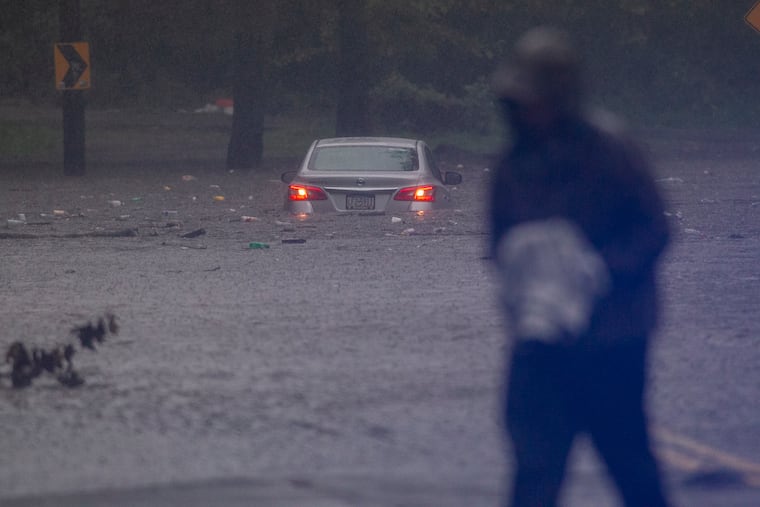
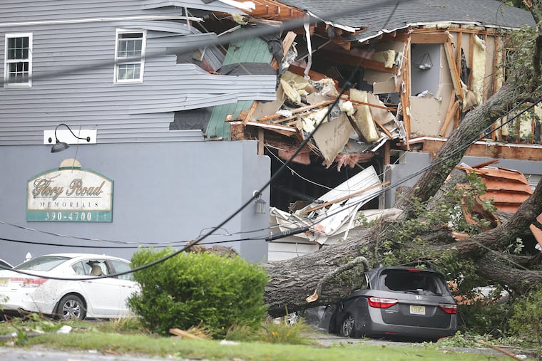
It didn’t take long for the region’s second tropical storm in less than four weeks to pull the plugs on 600,000 utility customers, spawn at least two tornadoes, break a rainfall record, and set off a flood of water rescues and high drama.
And Isaias’ effects could linger into early Wednesday with the potential for historic flood levels along the cresting Schuylkill.
The river was expected to crest sometime after midnight and reach 15.4 feet. Gary Szatkowski, a meteorologist retired from the National Weather Service, tweeted that the crest would be the second highest on record. “This would be the highest river level since 1869 ... over 150 years ago,” he wrote.
» READ MORE: Vine Street Expressway, SEPTA Regional Rail shut down because of unsecured barge
“The worst of this event is yet to come,” Adam Thiel, Philadelphia’s fire commissioner and director of its Office of Emergency Management, said Tuesday afternoon.
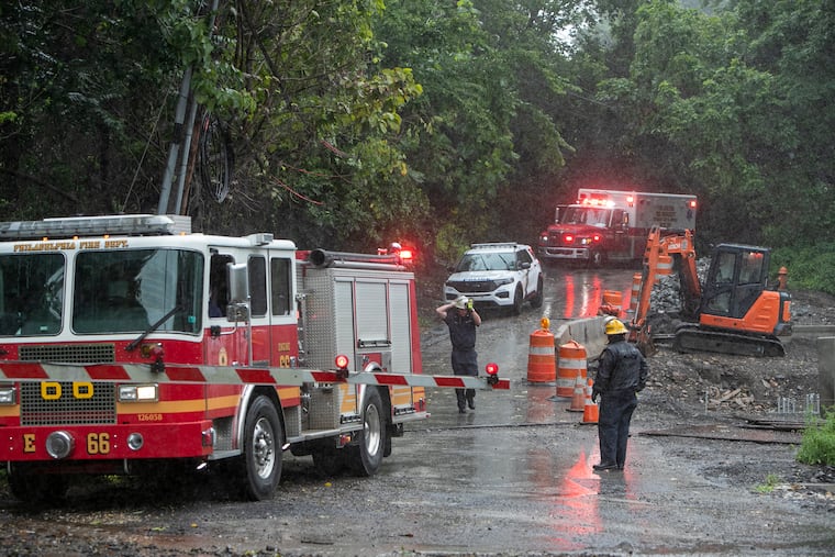
In the hard-hit Eastwick section of Southwest Philadelphia, the Office of Emergency Management is urging residents to evacuate from their homes if there is more than a foot of flood water or their utilities are not working. The office and the Red Cross set up shop at a nearby Rite Aid store to help residents.
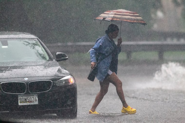
Meteorologists say they were mildly surprised by the speed with which Isaias zipped through the region, and to be seeing the sun so quickly on Tuesday afternoon. But before that in some places, the downpours were ferocious — almost like dam bursts from the skies.
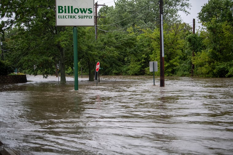
The rainfall totals read like they had walked out of a winter-storm summary. The six to eight inches in some of the northern and western suburbs were too much for some drainage systems and streams.
A 5-year-old autistic Montgomery County girl who wandered outside at the height of the storm was reported missing, as was a Delaware County teenager.
As the rain poured, stream levels rose astonishingly. For example, Chester Creek, which crested at 17 feet, double its flood stage, normally meanders at about 62 cubic feet per second. On Tuesday, it hit 7,650, well more than 100 times its normal flow.
» READ MORE: In South Jersey, ‘panic mode’ as tornado came out of Strathmere and tore up Route 9
The Wissahickon Creek jumped out of its banks and into the headquarters of the nonprofit environmental group Wissahickon Trails.
“The driveway was just a waterfall,” Gail Farmer, the group’s director, said after she and others went to assess the damage from the water that rushed into the first floor, which has concrete flooring. “Everything is covered in mud,” Farmer said. “Furniture. File cabinets. Anything that touched the floor.”
In addition to sloshing over in Philadelphia, the Schuylkill was forecast to reach “major” flood stage early Wednesday near Norristown.
The storm knocked out service to SEPTA’s Regional Rail and Norristown High-Speed lines for several hours.
Philadelphia’s official total of 4.16 inches set a record for an Aug. 4, and incredibly, almost 30% of the city’s precipitation since Jan. 1 has fallen on July 10, the day of storm Fay, and Tuesday.
» READ MORE: Philly received 25% of its total 2020 precipitation in just one very rainy week
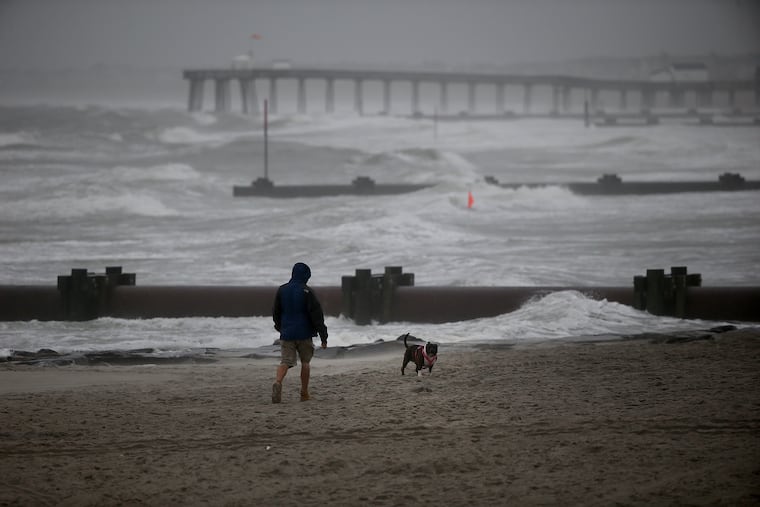
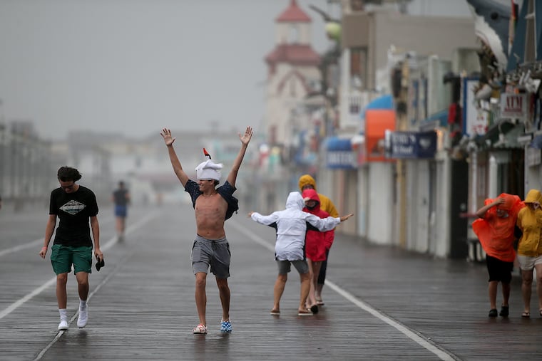
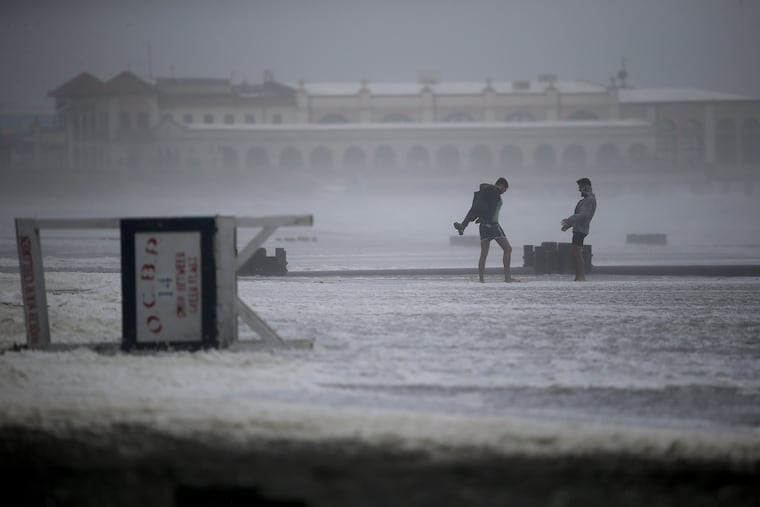
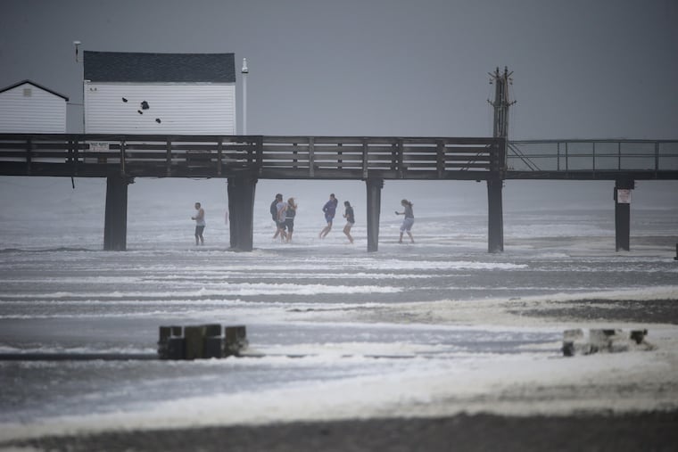
Only about a third of an inch was measured in Atlantic City, but the Shore more than compensated for any lack of rain with drama. Children at a day-care center near Ocean City had to take shelter against what almost certainly was a tornado.
Winds near the Shore gusted to 75 mph, or hurricane force, and toppled the steeple of Central Ocean City Union Chapel.
West of the Delaware River, the winds weren’t quite as extreme, but they weren’t gentle breezes either. Wilmington measured a gust of 59 mph, and the Philadelphia airport had one of 47.
And strong winds, or perhaps a tornado, blew off the roof of Children’s Village, a day-care center for children of Doylestown Hospital workers.


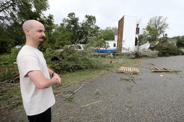


In the driving rain and wind, Jim Brexler, the hospital’s chief executive officer, and some of his staff helped police officers and firefighters to herd 135 children and their teachers out of the area, escorting them into a nearby radiology building, where they rode out the storm in a basement.
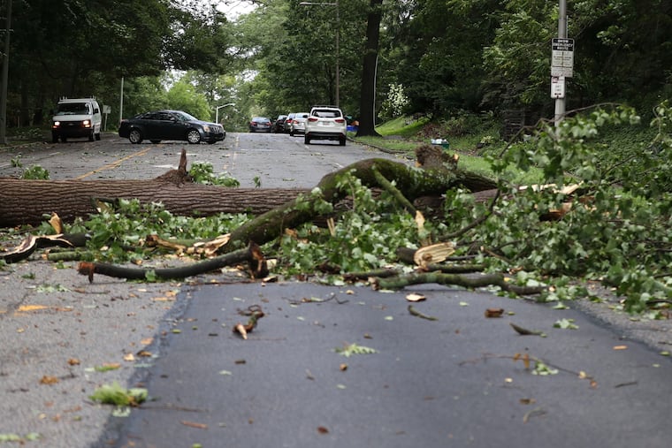
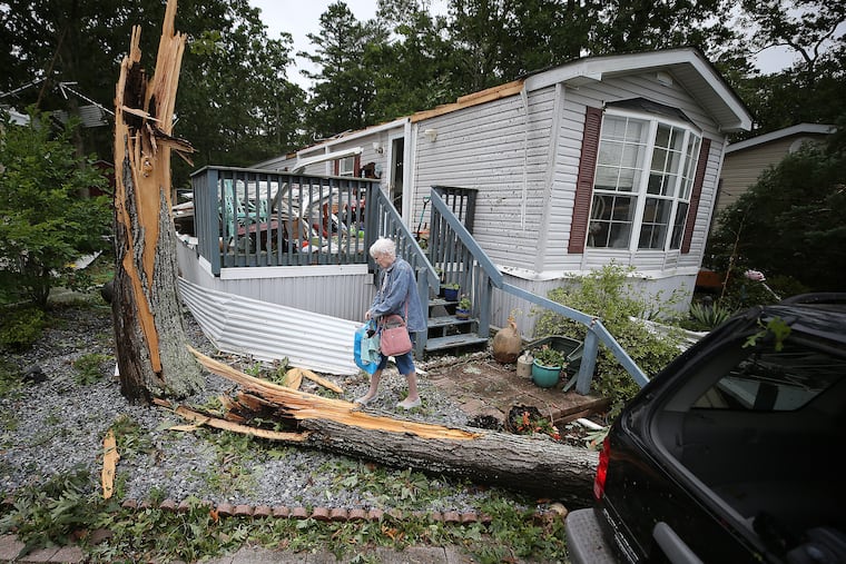
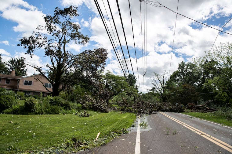
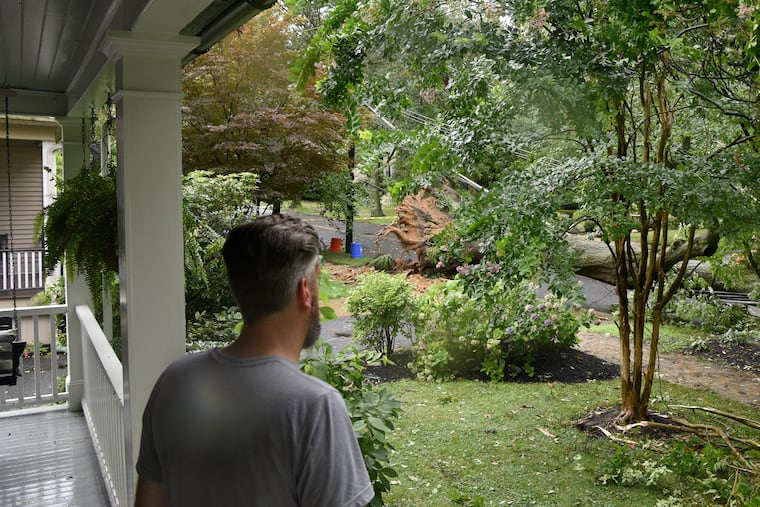
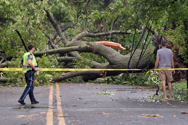
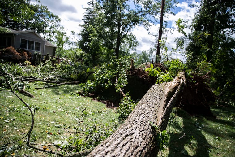
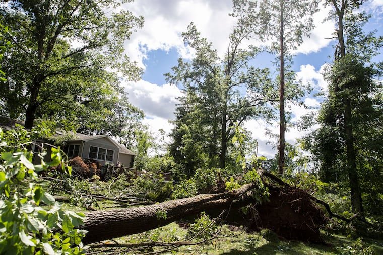
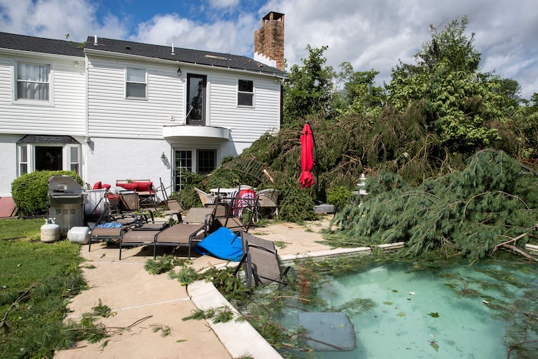
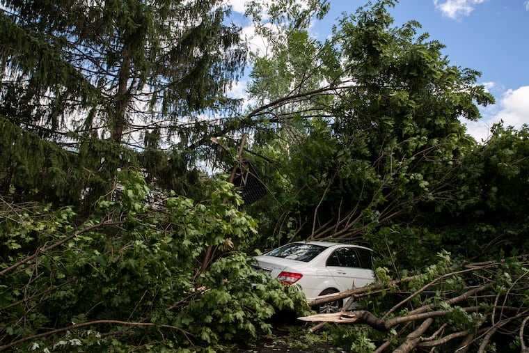
Likely working in tandem with the root-saturating rains, the winds took down trees, branches, and power lines.
» READ MORE: Most warnings are false alarms, but tornado watches get attention — with good reason
“This is going to be a tough one,” said Lauren Ugorji, a spokeswoman for Public Service Electric & Gas Co., which reported that more than 133,000 of its customers in South Jersey lost power. “Customers should expect delays.”
While the Shore didn’t have the saturating rain, it had the winds, and that bumped up the outage total for Atlantic City Electric, which reported that 190,000 of its 545,000 customers had lost power.
“We have pretty extensive damage to our local electrical distribution system,” said Frank Tedesco, an Atlantic City Electric spokesperson.
Peco Energy, which has more than 1.6 million customers in Philadelphia and Southeastern Pennsylvania, had more than 300,000 customers lose service at the storm’s peak, said Steven Singh, vice president of technical services. The outages were heaviest in Chester and Bucks Counties.
Those also happened to be areas where the heaviest rainfall was reported, with totals up to eight inches, or more than two normal months’ worth of rain, and, yes, that would be one heck of a snowstorm. That’s the water equivalent of about seven feet of snow.
To the west of the Shore, Isaias was interacting with a leftover weak front that was enhancing the rainfall, said Dave Dombek, a meteorologist with AccuWeather.
That rain got an additional lift from the so-called fall line, a subtly elevated area where the land rises toward the mountains from Philadelphia on the west. Wind coming off the ocean tends to rise and wring out more rain when it is forced upward.
“I think that definitely played a role,” said Dombek. As the storm cut through New Jersey, areas to the east of the center were on the drier but more-volatile side.
Patrick O’Hara, a meteorologist at the National Weather Service office in Mount Holly, said the storm moved so quickly because it was riding upper-air steering winds that were unusually strong for this time of year.
But despite its urgency to leave the area, Isaias was disruptive no matter what side of it you were on. At least one tornado was confirmed in Delaware.
Delaware County officials responded to 250 emergency calls, most for water rescues. Montgomery County dispatched crews for 114 of them, and was still at it Tuesday night.
The forecast does promise benign cleanup weather for Wednesday, with sunny skies and highs in the upper 80s. Then, shower chances return by Thursday and continue into Saturday.
On the positive front, for now the heat has been routed. Not a single 90 is in the forecast from here to Tuesday.
Staff writers Laura McCrystal, Ellie Rushing, Robert Moran, Andrew Maykuth, and Amy S. Rosenberg contributed to this article.


