The Canadian smoke over Philly is likely unprecedented, and it may be here the rest of the week
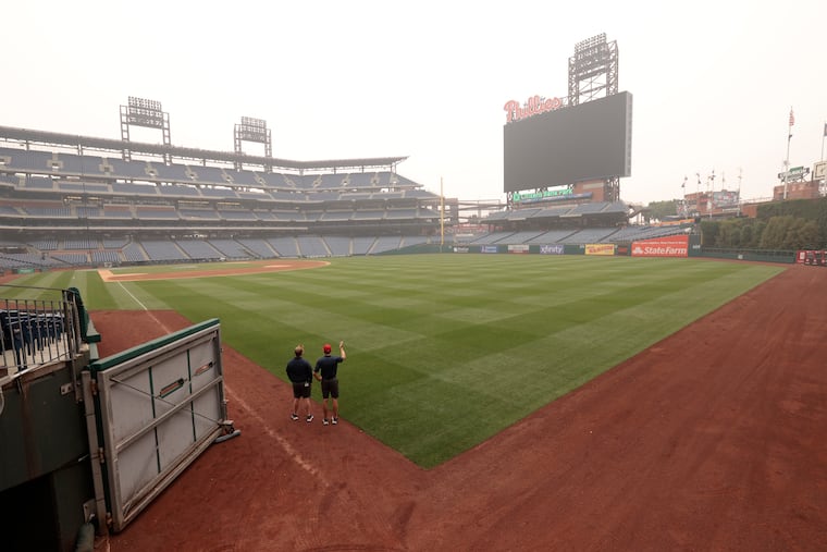
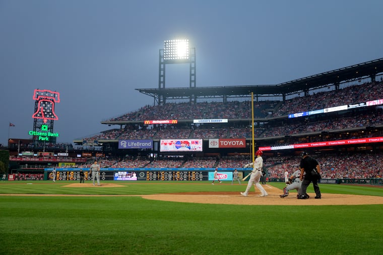
The smoke resulted in the Phillies' first "smoke out" in the team's 140-year history. The smoke finally should clear during the weekend.
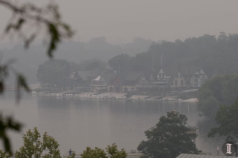
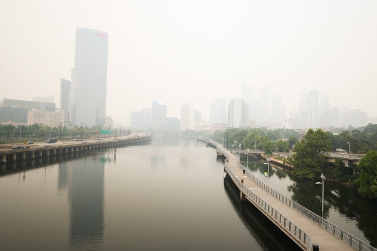
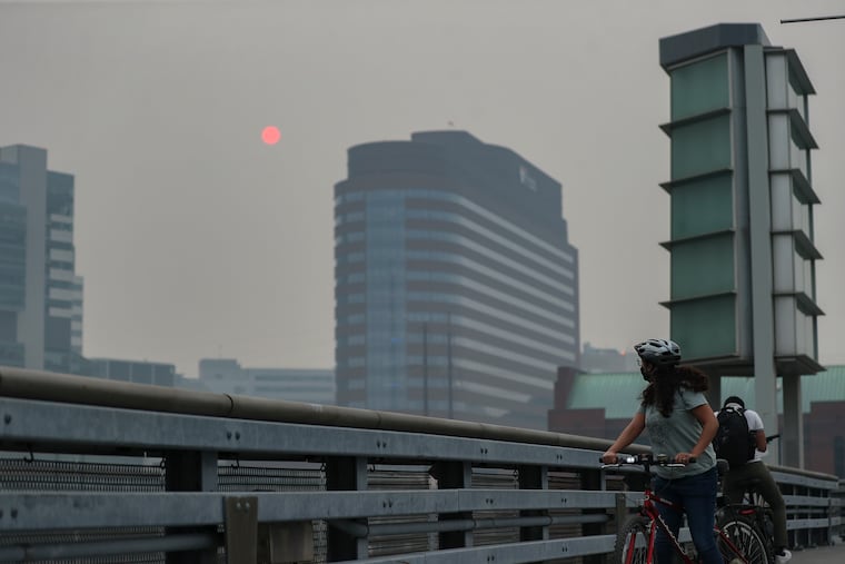
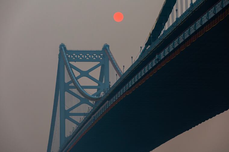
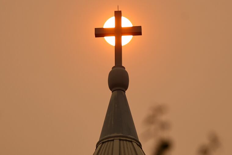
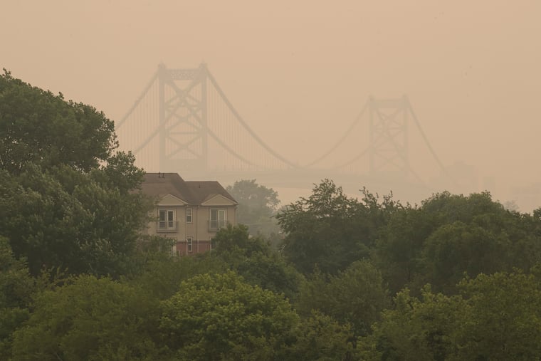
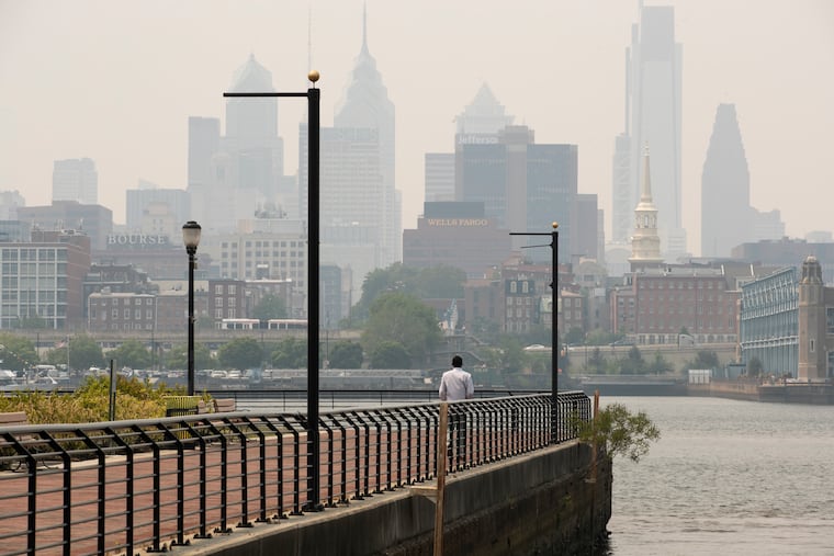
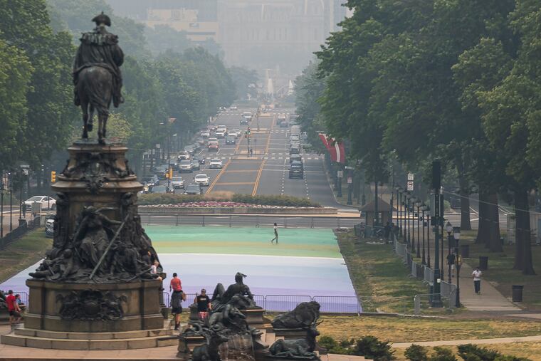
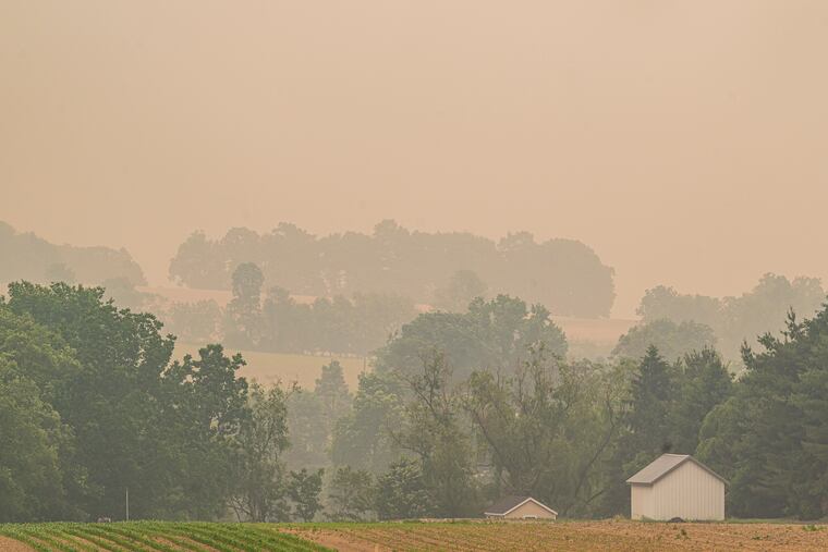
That eye-burning Canadian smoke that at times has made the entire Philadelphia region smell like a fire scene, and driven air quality to unhealthful depths not experienced in 15 years, may linger well into the weekend.
If you feel as though you’ve been inhaling the Canadian woodlands the last few days, you have.
It’s not over, but environmental officials and meteorologists believe that late Wednesday may have marked the apex of the fallout from the smoke that has shrouded one of the nation’s densest population corridors from New England to Virginia.
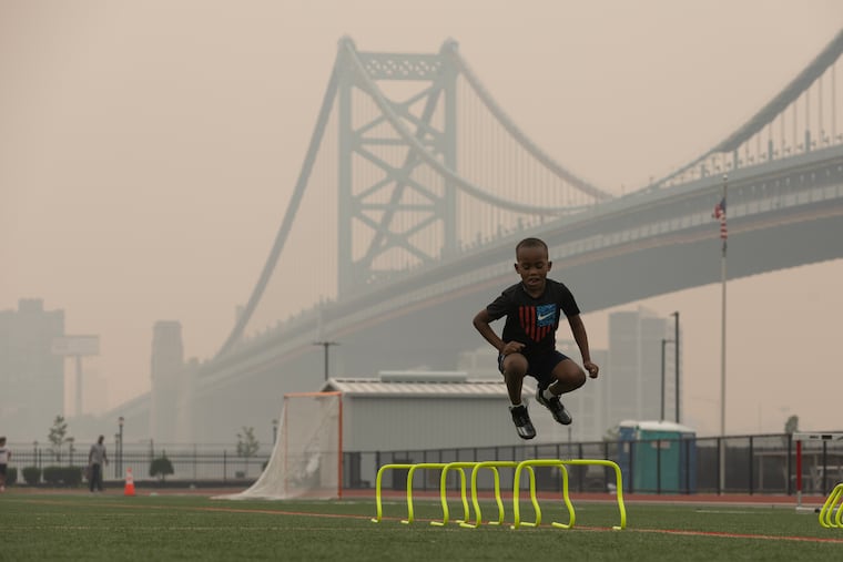
In the Philly region it disrupted school activities, moved officials to advise people to stay inside, and led to the postponement of the Phillies’ game, believed to be the first “smoke out” time in the team’s 140-year history.
“It’s pretty wild that a good portion of the northern part of the country is seeing effects of wild fires,” said Phillies injured first baseman Rhys Hoskins, a California native well familiar with wildfire smoke. “It’s terrible.”
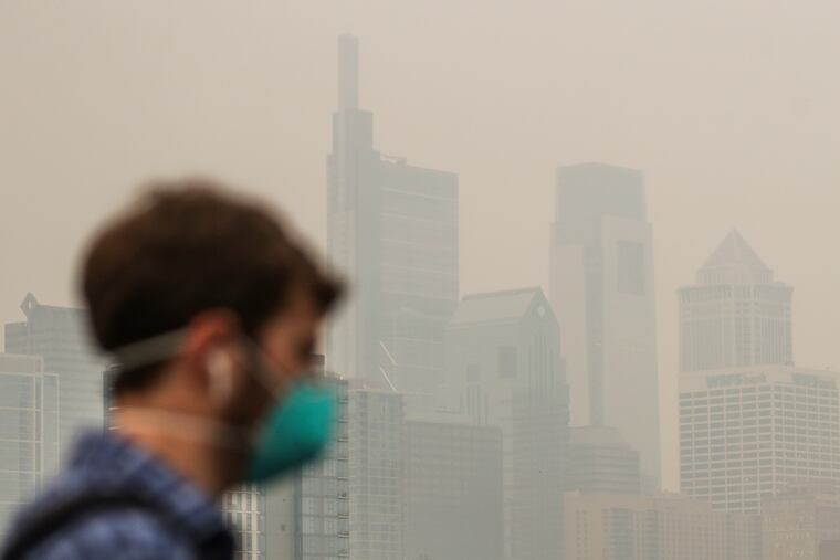
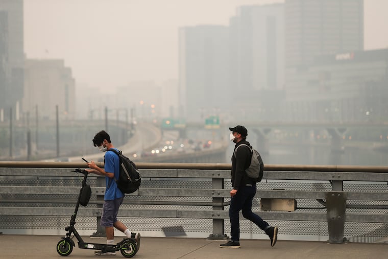


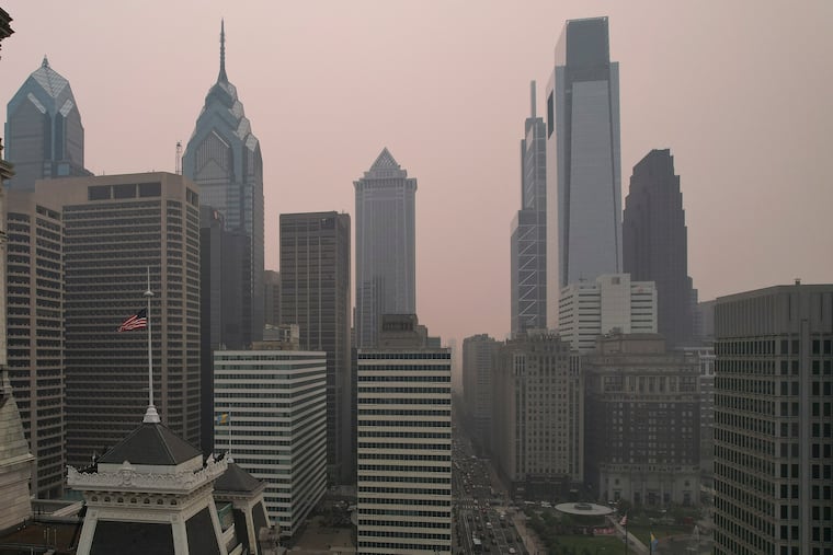


The regional Air Quality Partnership had Philly under a “code orange” alert for Thursday as of Wednesday evening. Although that’s not quite as ominous as the “very unhealthy” purple range and “hazardous” maroon level reached Wednesday, the air would be considered potentially hazardous to those with respiratory and heart conditions.
Perhaps it could have been worse around here Wednesday. It was, to the north: New York City recorded its worst air quality level on record.
People all over the Northeast might reasonably wonder if this is a harbinger of the future. Atmospheric scientists say it is going to take some time to tease out the specific contributions of climate change.
» READ MORE: Smoke from Nova Scotia blanketed Philly skies last month
“Whenever you have natural disasters you have more than one factor,” said John Gyakum, meteorology professor at McGill University. But, yes, he and others say the warming of the planet clearly has been an agent in a sequence of events that might well be unprecedented.
Those Canadian fires
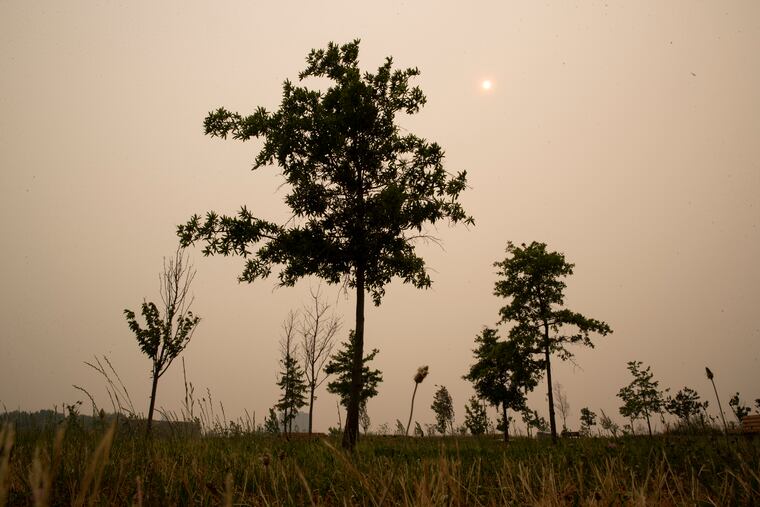
The Canadian wildfire statistics this year are astonishing. The acreage burned to date is 10 times the normal, according to government statistics. “It’s like all of Canada’s on fire,” said Tom Kines, senior meteorologist with AccuWeather Inc.
The situation in Quebec, the source of this week’s smoke, is even more extreme, with charred acreage more than 500 times greater than normal.
Amy Freeze, a Fox Weather meteorologist in smoky New York, said the fires may have had their origins with the remnants of Tropical Storm Fiona in September, which mutated into a powerful cyclone in the Canadian Maritimes.
It took down trees in Nova Scotia that were kindling for the fires that produced smoke over Philly last month. In Quebec, a beetle infestation resulted in more dead, combustible wood, ripened by a mild winter and a bone-dry May, similar to ours.
» READ MORE: Philly had its driest May on record, and some parts of the region were even drier
Lightning strikes evidently supplied the sparks for what almost certainly is going to be a record fire season for the province.
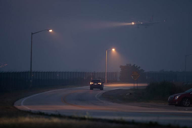
The blazes were extraordinary in and of themselves, however, it was quite an unusual weather pattern that drove the smoke across the Northeastern United States.
Quirk of winds
In June, winds usually blow from the southwest across Philadelphia. However, in recent days, persistent winds from the north have funneled the smoke southward from the fires.
“It’s a peculiar structure to the wind,” said McGill’s Gyakum. “It’s a particularly lethal flow for populated areas.”
Fox’s Freeze said the winds are tied to what has been a persistent pattern that has dried up much of eastern North America and deluged parts of the the West.
That so-called blocking pattern may well be symptomatic of the warming planet, said Gyakum.
The fallout
Wildfire smoke in the skies of Philly is not a new phenomenon. Numerous times smoke from Northwest wildfires has made its way to the East Coast.
» READ MORE: Many Philly schools aren’t air-conditioned, but windows were ordered closed Wednesday
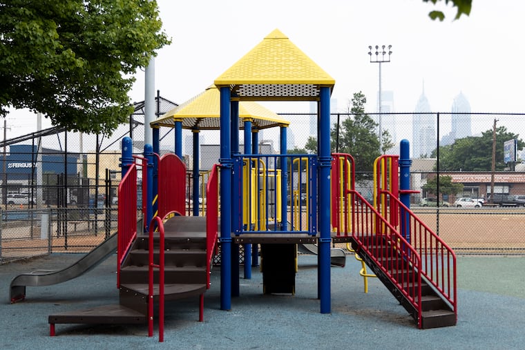
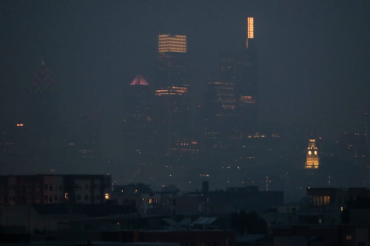
But that smoke has been about 25,000 feet in the atmosphere. This week, it has arrived at eye level.
Philly’s air quality index for fine particulate matter — matter that’s 30 times smaller than the diameter of a human hair — reached the “purple” range for the first time since April 21, 2008. While the EPA data did not address why levels were so extreme that day, articles in The Inquirer and Daily News chronicling the reading followed an overnight seven-alarm warehouse fire in Frankford.
On Wednesday, Philly schools decided to keep their windows closed, even though some buildings don’t have air-conditioning.
Across the Delaware River, many school districts including Camden, Cherry Hill, and Collingswood held recess and physical education indoors and canceled outside field trips.

Officials suggest you should:
- Strongly consider canceling outdoor events and gatherings.
- Avoid going outdoors as much as possible.
- Avoid excessive activities outdoors, such as running or other exercise.
- Wear a high-quality mask, such as an N95 or KN95, If you have to go outdoors.
- Avoid areas of high congestion and where air pollution may be higher, such as main streets or highways, and areas with low air circulation.
- Close all windows and doors to minimize air pollution in your home.
- Recirculate the air in your home with fans to avoid bringing in more pollution.
- Pay attention to your body: If you are having trouble breathing, feeling nauseous, or dizzy, seek medical attention as soon as possible.
Officials are also asking asking you to:
- Avoid unnecessary car trips.
- Not leave vehicles idling.
- Carpool.
- Avoid using gas-powered mowers and weed whackers.
Coming attractions
The smoke will clear. Expect to see smoke in the skies here at least through the day Saturday, although forecasters say it likely will be significantly less intense. Then the winds finally should shift late in the weekend, they say.
“All that smoke is going to get stuffed back into Canada,” said AccuWeather’s Brett Anderson, a wildfire specialist.
But given the way the planetary temperature has been increasing, he said, “We’re probably going to see more events like this in the future.”
Staff writers Emily Block, Melanie Burney, Alex Coffey, Kristen A. Graham, Maddie Hanna, Nick Vadala, and Aubrey Whelan contributed to this article.


