Parts of Florida see half a year’s worth of rain in 36 hours
About half a year’s worth of rain - up to 28 inches - fell along portions of Florida’s Space Coast in just a day and a half, from Sunday afternoon to Monday evening, according to radar estimates.
About half a year’s worth of rain — up to 28 inches — fell along portions of Florida’s Space Coast in just a day and a half, from Sunday afternoon to Monday evening, according to radar estimates.
“I’ve NEVER seen anything like this,” wrote Tampa-based meteorologist Jeff Berardelli about the event, which was so rare that it had a recurrence interval of more than 1-in-1,000 years in some areas — and it could be a sign of what’s to come as the state braces for an unusually active winter thanks to El Niño.
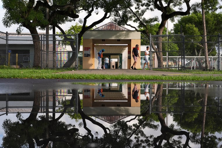
Florida officials also scrambled Tuesday morning to move more than 20 polling places that had been impacted by the extreme weather, with the Florida secretary of state’s office publishing a list of locations it said would be moved to “ensure that residents in those areas in affected counties still have the ability to vote.”
The moved sites are spread across Brevard, Broward, Highlands, Indian River, Martin, Okeechobee, Palm Beach, and St. Lucie Counties.
On Monday afternoon, Florida Gov. Ron DeSantis (R) declared a state of emergency for seven counties in the eastern and central part of the state that were hit hardest by the multiday deluge.
These counties, including Brevard, DeSoto, Hardee, Highlands, Indian River, Martin, and St. Lucie, received around 20% to 50% of their annual average rainfall from Sunday afternoon to Monday evening.
The heaviest rain occurred in a stretch from Palm Bay to Grant-Valkaria in Brevard County, where homes, vehicles, and roads were flooded.
A weather station in Sebastian, Fla., tallied 7.13 inches in just three hours’ time Monday between 9 a.m. and 3 p.m.
Valkaria, east of Palm Bay and southeast of Melbourne, logged 11.32 inches between 6 and 10 a.m.
The historic deluge was triggered by a relatively weak atmospheric disturbance that stretched and stalled over the region from Sunday into Monday.
To the north of this system, wind flows around a strong area of high pressure — the same one responsible for the mid-Atlantic’s lengthy dry stretch — helped to steer tropical moisture toward Florida from record-warm ocean waters east of the Bahamas.
Weak winds through the middle atmosphere caused the storms to move slowly, in many cases moving repeatedly over the same areas.
The fully saturated atmosphere also lead to higher precipitation efficiency — and therefore higher rainfall rates. Generally, part of a raindrop evaporates as it falls. But when the atmosphere is particularly humid, there’s no dry air to erode the drop, and more of the water makes it to the ground.
Rainfall rates exceeded 4 inches per hour at times.
Forecasts initially outlined a marginal or slight risk of flash flooding and excessive rainfall — but the idea of feet of rain falling came without warning.
Even just 15 miles away, barely 2 inches of rain fell. The National Weather Service had issued a flash flood emergency for near Bogalusa, Miss.
In both episodes, storms also harnessed higher levels of atmospheric moisture that have been boosted by a record El Niño and a warming climate.
Earth’s atmosphere recently had its most waterlogged month on record during August, followed by another monthly record in September.
“It’s going to be a long winter in Florida,” wrote Paul Roundy, an atmospheric science professor at the State University of New York at Albany.
Florida’s dry season runs from October through May, but amid a particularly potent El Niño, midrange forecast scenarios show around 2 feet of total rainfall from this year into next, and the most extreme scenarios indicate up to around 3 feet — about as much precipitation as D.C. receives in a typical year.
During El Niño winters, both tornado and flash flood activity increase in the Southeast, and especially Florida. El Niño, which begins as a warming of water temperatures in the eastern tropical Pacific, reshuffles the positions of key weather systems across North America. That slings the subtropical jet stream across the southern U.S.; like a conveyor belt of winds and moisture, it pumps humidity into Florida, while simultaneously providing wind shear (changing winds with height) to help generate rotating thunderstorms.
The closest modern El Niño precedent is the winter of 1997-98, when Florida’s deadliest tornado outbreak struck the Orlando area in February 1998. From November 1997 to March 1998, almost 40 inches of rain fell in Tampa.
According to data from the Florida Department of Health, the state’s population has grown from about 15 million to over 23 million between 1998 and 2024 — an increase of about 50%.
That means more people may be exposed to potentially hazardous weather in the months ahead, including snowbirds who head south for Florida’s typically pleasant winter climate.