More severe storms are possible this week in the Philly region
A tornado warning was issued for parts of Burlington County.
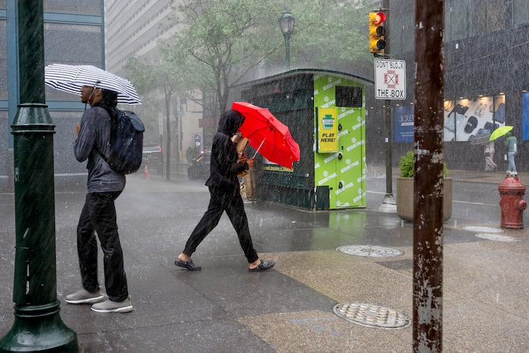
Officially the meteorological fall has begun in Philly, and unofficially it’s beginning to feel a lot like August.
Along with a heat advisory — the heat index hit 100 Tuesday afternoon — the National Weather Service is warning the region may be in for another one of those random storm outbreaks that so characterized August.
The weather service issued a tornado warning around 9:05 p.m. for areas in central Burlington County — including for the weather service office in Mount Holly. The warning was based on radar imaging.
Flood warnings were up for Chester, Delaware, Camden, and Gloucester Counties. The Collings Lakes Fire Department reported that “multiple roads” in Williamstown, Monroe Township, were “under water.”
Storm winds reportedly took down trees and wires in several communities in western Chester County, the weather service said, and a tree fell upon Morgantown Road in the West Nantmeal Township area.
And a severe thunderstorm watch, for storms with gusts approaching 60 mph, was in effect Tuesday until 11:59 p.m.
“Our biggest concern is damaging winds,” said Sarah Johnson, warning coordination meteorologist at the weather service’s Mount Holly office. “But we can’t rule out the potential for a tornado.”
Sound familiar?
What to expect in the Philly region the next few days
Outside of snow, almost anything.
In addition to the Tuesday night watch, strong storms are possible Wednesday, and while probabilities are lower during the day Thursday, Johnson said at least one computer model was showing the potential for a “squall line” of storms to approach the region.
Clouds likely will hold down temperatures Wednesday, but they are expected to reach 90 or better Thursday and the heat index might shoot past 100.
Is August expected to end soon?
The atmosphere is due to start cleaning it up on Friday, and the Labor Day weekend is looking spectacular, with the caveat that it’s only Tuesday.
However, the next three days are looking more like they belong to the August rinse-repeat cycle.
Once again, the region is likely to experience “ring of fire” thunderstorms from storm-generating impulses along the edges of heat-producing high pressure, said Chad Merrill, senior meteorologist at AccuWeather Inc.
The sequence has become familiar since mid-June as the edges of the high pressure retreat and allow the storms to develop.
An overall result has been a remarkable turnabout in the region’s drought fortunes, even though New Jersey remains under a drought “warning.”
During what the weather community calls the “meteorological summer,” the June 1 to Aug. 31 period, Philadelphia experienced 17 inches of rain, Merrill said, good for 14th place for the three-month period in records dating to the 1870s.
The meteorological fall really did begin Tuesday. Not that the atmosphere noticed.
This story will be updated.