Storms move through the Philly region, bringing the potential for tornadoes and flooding
PATCO and NJ Transit experienced disruptions due to the storm.
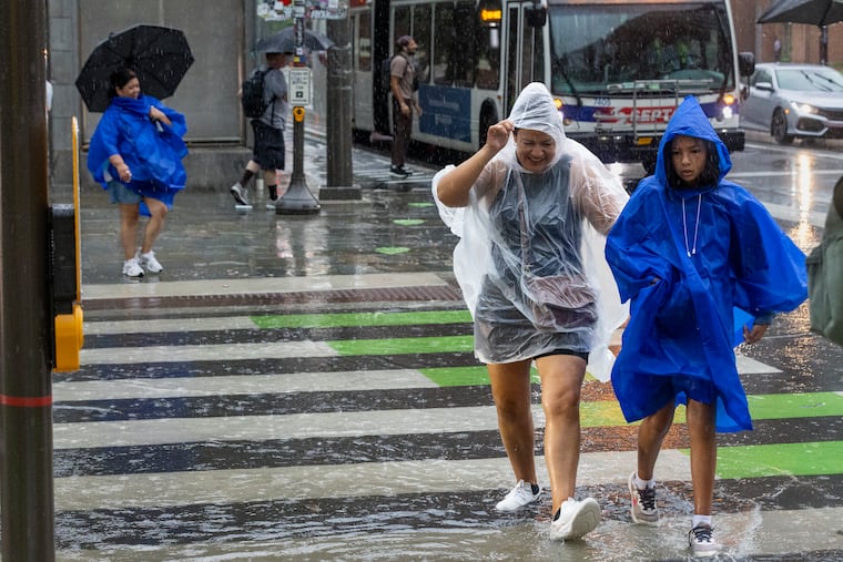
Severe storms were moving through the Philadelphia region Tuesday, bringing with them the potential for flooding and tornadoes.
The National Weather Service office in Mount Holly issued a flash flood warning for the area that was slated to be in effect through 8:45 p.m. Tuesday, as thunderstorms and heavy showers made their way to the region. Forecasters had predicted potentially unsettled weather that was expected to bring “several rounds” of rain.
“Even the first round we get could result in flooding,” said Paul Fitzsimmons, lead meteorologist at the weather service’s Mount Holly office. “With successive rounds, that results in an increased threat.”
The idea, Fitzsimmons added, is that once the ground is saturated with rain, the precipitation from future rounds of rain will have few places, if any, to go.
On Tuesday afternoon, the weather service also issued a tornado watch for the Philadelphia region and beyond. That tornado watch, which the weather service said applies to parts of Pennsylvania, New Jersey, Delaware, New York, and Connecticut, is in effect through 9 p.m. Tuesday.
The tornado watch impacts more than 32 million people, and covers possible tornados, scattered, ping pong ball-sized hail, and wind gusts of up to 70 miles per hour, according to the weather service.
Initial strong rains had some impact on the region. PATCO service, for example, was temporarily suspended over signal issues caused by the storm. NJ Transit’s River Line was saw a suspension due to flooding in Camden. And Philadelphia International Airport warned travelers that the weather could impact their flights, and advised flyers to check with their airlines for up-to-date information.
Additional, more organized rounds of rain were expected to arrive later in the day, with multiple storms potentially hitting the region into the overnight period, according to the weather service. Rainfall rates could push into the neighborhood of one to two inches per hour at times.
The most severe weather, which could bring damaging winds, hail, and a possible tornado, was expected to arrive between 2 p.m. and 8 p.m., Fitzsimmons said.
Tuesday saw high temperatures in the 80s, but with very high humidity to start out. The storms were expected to alleviate some of that humidity, opening the way for cooler, drier days to come later this week.
Tuesday’s storms are the latest to descend upon the Philadelphia region. Severe weather was predicted for Saturday, but largely remained tame, and the previous weekend, a series of “microburst” storms with high winds toppled hundreds of trees in the area, leading to serious, localized damage in the city and suburbs.
It is not uncommon for weather setups to arrive with similar impacts in this way, Fitzsimmons said. It is, however, hard to say how long those patterns might last.
“There is something to the idea where you can get into patterns that repeat themselves,” he said.