Shore flooding and strong winds could last days as an early nor’easter threatens the Philly area
So-called cold-air damming is going to make it feel like mid-October.
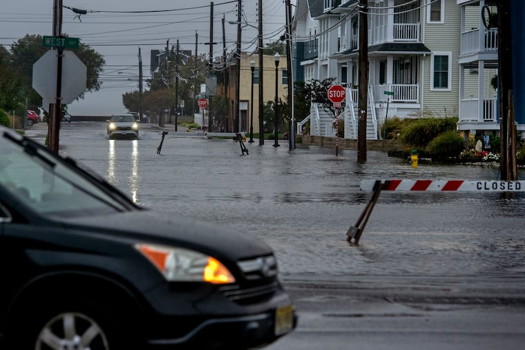
With the astronomical summer about to call it a season, the atmosphere is executing an equinoctial flip to mark the arrival of fall with impacts that could last several days.
With an unusually early nor’easter due to form off the Atlantic coast this week, strong onshore winds in combination with the approaching full moon could result in coastal flooding and significant beach erosion at the Shore in what is likely to be the coolest week since early May.
The National Weather Service office in Mount Holly has issued a flood advisory for the Shore areas for minor flooding late Tuesday afternoon, and a watch for the potential of moderate flooding late Wednesday afternoon into the evening.
In addition, it said, “Moderate tidal flooding could continue through at least Friday evening’s high tide or perhaps longer.”
An advisory for minor flooding along the Delaware River in Philly likely will be added Wednesday into Thursday, said weather service meteorologist Eric Hoeflich.
Potent winds from the northeast could persist through the weekend from the Outer Banks of North Carolina to the Jersey Shore, said Brian Hurley, senior branch forecaster with the federal Weather Prediction Center, in College Park, Md.
When winds and rains may arrive in the Philly region
The nor’easter likely won’t develop until Wednesday, said Hurley, but rain and strong onshore winds aren’t going to wait for the party to start.
Showers are likely Tuesday throughout the region, with winds from the northeast gusting to 35 mph at the Shore, starting Tuesday and continuing into late Sunday night. They are likely to generate beach-eating storm waves. Inland, gusts in the range of 25 mph are forecast for the immediate Philly region, lasting about as long.
It should be dry in South Philly Tuesday night when the Phillies host the Milwaukee Brewers, but it literally will feel like October, with temperatures around 60 degrees at game time. Readings the rest of the week aren’t expected to get out of the 60s, several degrees below normal.
Rain is possible Friday, but how much falls later in the week and during the weekend will depend on how intense the coastal storm becomes and precisely how it tracks.
If you’ve lived around here for a while, that may sound familiar.
“It’s not different from what we talk about in the winter when we try to determine where the snow” is going to fall, said Dan Pydynowski, forecasting supervisor at AccuWeather Inc.
What is all but certain is that those beach-eroding and flood-inciting onshore winds are going to have staying power.
What’s going on up there?
An area of strong fair-weather high pressure, over heavier air, over southeastern Canada is forecast to hold its ground for the next several days. Said Pydynowski, this is “a very strong high for this time of year.”
As the storm intensifies to the south, it also will be stirring up onshore gusts across the region. Winds blow counterclockwise around storm centers, and areas to the northwest of the center experience northeast winds. That’s why they are called “nor’easters.”
Between the two systems, the region is in for a major wind-fest.
Regardless of whether the system becomes a significant rainmaker, said Hurley, “I think we’re going to have coastal flooding erosion issues from the Outer Banks all the way up through the Delmarva and the Jersey Shore for several days in a row.”
In addition to the winds, the areas along I-95 will experience so-called cold-air damming, the result of chilly northeast winds being dammed in by the Appalachian Mountains to the west.
“It’s a very weird time of year to get it,” Pydynowski said.