TravelA snowy New England escape in Manchester, Vt. | Field TripFrom skiing and spa days to historic estates, indie bookstores, and cozy dining, Manchester, Vermont is a Hallmark-worthy winter getaway less than five hours from Philly.Adam Erace Offseason eats, arcades, and live music in Asbury Park | Field TripAdam Erace Pizza, museums, and waterfront walks in New Haven | Field TripAdam Erace, For The Inquirer Waterfalls, cabins, art, and eats in Milford, Pa. | Field TripJason Nark Antiques, river hikes, and cozy inns in Lambertville and Stockton | Field TripAdam Erace, For The Inquirer AdvertisementCharm City eats, museums, and waterfront stays in Baltimore | Field TripBaltimore is the most Philly city on the Acela corridor. From coffee and conservatories to the aquarium, museums, and standout dining, here’s how to spend a long weekend in Charm City.Adam Erace Traveling this holiday? Here’s the weather and travel forecast for the week.Here is Philadelphia's weather and travel forecast for the holiday season, including the best times to travel and whether there will be snow on Christmas Day.Henry Savage Cozy inns, vintage finds, and wintery walks in the Western Catskills | Field TripStay at a lakeside inn, browse vintage shops in Callicoon, warm up with cider and roast beef, and explore galleries and forest trails. Here’s how to spend a winter weekend in the Western Catskills.Adam Erace A winter getaway with chocolate, caverns, and holiday lights in Hershey, Pa. | Field TripWarm up in Hershey, Pa., with a stay at the iconic Hotel Hershey, underground explorations in Indian Echo Caverns, festive lights at Hersheypark, and craft brews at Tröegs.Adam Erace Holiday shopping, coastal trails, and craft beer in Lewes & the Delaware Beaches | Field TripTake the Cape May–Lewes Ferry, explore festive shops and coastal trails, sip Dogfish Head brews, and dine in Rehoboth Beach — here’s how to spend a winter weekend in Lewes and the Delaware Beaches.Adam Erace Flight schedules will return to normal at PHL ahead of Thanksgiving and holiday travel seasonPhiladelphia International Airport will be back to business as usual ahead of Thanksgiving, with the FAA dropping flight restrictions after the government shutdown ended.Henry Savage Lakeside glamping, a presidential home, and international eats in Lancaster | Field TripTour a president’s mansion, chill at a lakeside cabin, and groove inside a Japanese listening lounge in Amish country — here’s how to spend a weekend in Lancaster, Pa., just 90 minutes from Philly.Beatrice Forman The FAA reduced flights at PHL Airport. Here’s what you need to know.The FAA has directed airlines to reduce flights by 10%. If your flight was cancelled or delayed, here are your options.Henry Savage Leaf peeping, murder mysteries, and mountain charm in Jim Thorpe | Field TripRide a scenic railway through fall foliage, shop Victorian streets, and dine in mountain charm — here’s how to spend a picture-perfect fall weekend in Jim Thorpe, Pa., just two hours from Philly.Adam Erace How to spend a spooky weekend in Sleepy Hollow, N.Y. | Field TripExplore haunted mansions, stroll historic cemeteries, solve eerie mysteries, and dine in style. Here’s how to spend a spooky fall weekend in Sleepy Hollow, N.Y., just two and a half hours from Philly.Adam Erace How to spend a scenic fall weekend in Delaware Water Gap, Pa. | Field TripLive jazz, apple pie, antique hunting, and fall foliage — here’s how to spend a cozy weekend exploring Delaware Water Gap, Pa., just two hours from Philadelphia.Adam Erace 20 farms near Philly for pumpkin picking, hayrides, corn mazes, and moreWhere to go for the best of fall in Berks, Bucks, Burlington, Camden, Chester, Delaware, Hunterdon, Lancaster, Mercer, and Montgomery counties.Henry Savage and Hira Qureshi Getting baked inside New Jersey’s flashy new cannabis loungesJoin Inquirer reporters inside New Jersey’s first legal weed lounges. With our video, see what it’s like to smoke legally in Atlantic City and just across the Ben Franklin Bridge.Henry Savage We made 10 predictions for the 2025 Shore summer. Here’s how we did.The summer season was good overall, not a slam dunk. It’s barreling to the end with some very large waves.Amy S. Rosenberg PATCO suspending weekday overnight trains for six months starting in September PATCO is addressing safety, cleanliness, and efficiency concerns during the six-month shutdown of weekday overnight service.Henry Savage See more storiesAdvertisement
A snowy New England escape in Manchester, Vt. | Field TripFrom skiing and spa days to historic estates, indie bookstores, and cozy dining, Manchester, Vermont is a Hallmark-worthy winter getaway less than five hours from Philly.Adam Erace
A snowy New England escape in Manchester, Vt. | Field TripFrom skiing and spa days to historic estates, indie bookstores, and cozy dining, Manchester, Vermont is a Hallmark-worthy winter getaway less than five hours from Philly.Adam Erace
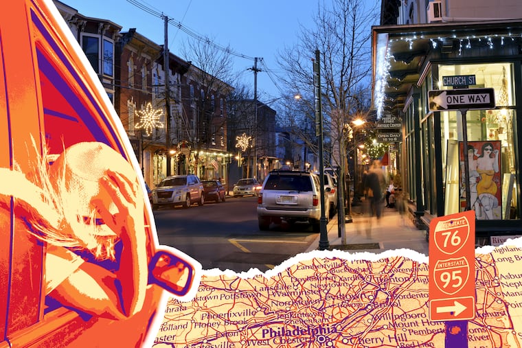
Antiques, river hikes, and cozy inns in Lambertville and Stockton | Field TripAdam Erace, For The Inquirer
Antiques, river hikes, and cozy inns in Lambertville and Stockton | Field TripAdam Erace, For The Inquirer
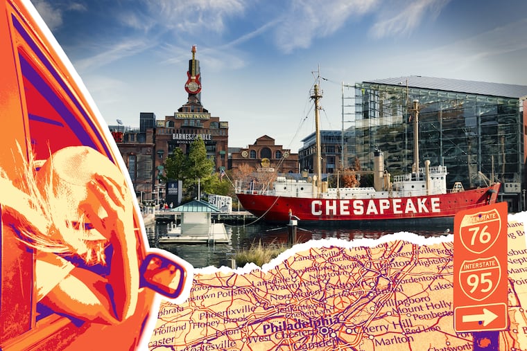
Charm City eats, museums, and waterfront stays in Baltimore | Field TripBaltimore is the most Philly city on the Acela corridor. From coffee and conservatories to the aquarium, museums, and standout dining, here’s how to spend a long weekend in Charm City.Adam Erace
Charm City eats, museums, and waterfront stays in Baltimore | Field TripBaltimore is the most Philly city on the Acela corridor. From coffee and conservatories to the aquarium, museums, and standout dining, here’s how to spend a long weekend in Charm City.Adam Erace
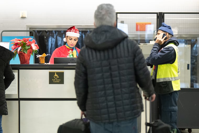
Traveling this holiday? Here’s the weather and travel forecast for the week.Here is Philadelphia's weather and travel forecast for the holiday season, including the best times to travel and whether there will be snow on Christmas Day.Henry Savage
Traveling this holiday? Here’s the weather and travel forecast for the week.Here is Philadelphia's weather and travel forecast for the holiday season, including the best times to travel and whether there will be snow on Christmas Day.Henry Savage
Cozy inns, vintage finds, and wintery walks in the Western Catskills | Field TripStay at a lakeside inn, browse vintage shops in Callicoon, warm up with cider and roast beef, and explore galleries and forest trails. Here’s how to spend a winter weekend in the Western Catskills.Adam Erace
Cozy inns, vintage finds, and wintery walks in the Western Catskills | Field TripStay at a lakeside inn, browse vintage shops in Callicoon, warm up with cider and roast beef, and explore galleries and forest trails. Here’s how to spend a winter weekend in the Western Catskills.Adam Erace
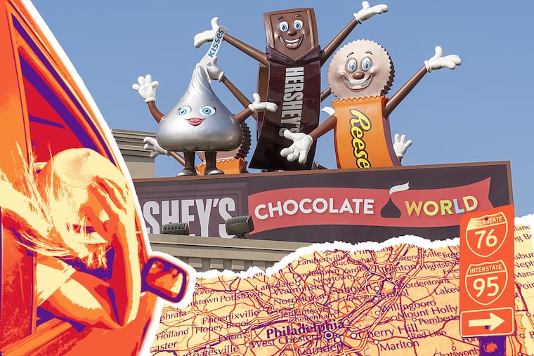
A winter getaway with chocolate, caverns, and holiday lights in Hershey, Pa. | Field TripWarm up in Hershey, Pa., with a stay at the iconic Hotel Hershey, underground explorations in Indian Echo Caverns, festive lights at Hersheypark, and craft brews at Tröegs.Adam Erace
A winter getaway with chocolate, caverns, and holiday lights in Hershey, Pa. | Field TripWarm up in Hershey, Pa., with a stay at the iconic Hotel Hershey, underground explorations in Indian Echo Caverns, festive lights at Hersheypark, and craft brews at Tröegs.Adam Erace
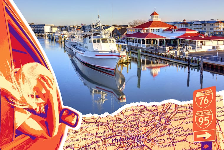
Holiday shopping, coastal trails, and craft beer in Lewes & the Delaware Beaches | Field TripTake the Cape May–Lewes Ferry, explore festive shops and coastal trails, sip Dogfish Head brews, and dine in Rehoboth Beach — here’s how to spend a winter weekend in Lewes and the Delaware Beaches.Adam Erace
Holiday shopping, coastal trails, and craft beer in Lewes & the Delaware Beaches | Field TripTake the Cape May–Lewes Ferry, explore festive shops and coastal trails, sip Dogfish Head brews, and dine in Rehoboth Beach — here’s how to spend a winter weekend in Lewes and the Delaware Beaches.Adam Erace
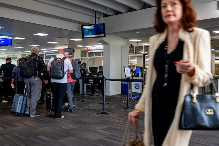
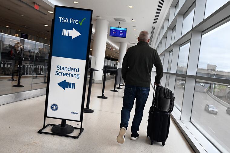
Flight schedules will return to normal at PHL ahead of Thanksgiving and holiday travel seasonPhiladelphia International Airport will be back to business as usual ahead of Thanksgiving, with the FAA dropping flight restrictions after the government shutdown ended.Henry Savage
Flight schedules will return to normal at PHL ahead of Thanksgiving and holiday travel seasonPhiladelphia International Airport will be back to business as usual ahead of Thanksgiving, with the FAA dropping flight restrictions after the government shutdown ended.Henry Savage
Lakeside glamping, a presidential home, and international eats in Lancaster | Field TripTour a president’s mansion, chill at a lakeside cabin, and groove inside a Japanese listening lounge in Amish country — here’s how to spend a weekend in Lancaster, Pa., just 90 minutes from Philly.Beatrice Forman
Lakeside glamping, a presidential home, and international eats in Lancaster | Field TripTour a president’s mansion, chill at a lakeside cabin, and groove inside a Japanese listening lounge in Amish country — here’s how to spend a weekend in Lancaster, Pa., just 90 minutes from Philly.Beatrice Forman
The FAA reduced flights at PHL Airport. Here’s what you need to know.The FAA has directed airlines to reduce flights by 10%. If your flight was cancelled or delayed, here are your options.Henry Savage
The FAA reduced flights at PHL Airport. Here’s what you need to know.The FAA has directed airlines to reduce flights by 10%. If your flight was cancelled or delayed, here are your options.Henry Savage
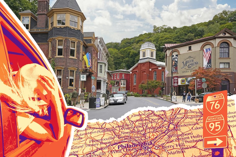
Leaf peeping, murder mysteries, and mountain charm in Jim Thorpe | Field TripRide a scenic railway through fall foliage, shop Victorian streets, and dine in mountain charm — here’s how to spend a picture-perfect fall weekend in Jim Thorpe, Pa., just two hours from Philly.Adam Erace
Leaf peeping, murder mysteries, and mountain charm in Jim Thorpe | Field TripRide a scenic railway through fall foliage, shop Victorian streets, and dine in mountain charm — here’s how to spend a picture-perfect fall weekend in Jim Thorpe, Pa., just two hours from Philly.Adam Erace
How to spend a spooky weekend in Sleepy Hollow, N.Y. | Field TripExplore haunted mansions, stroll historic cemeteries, solve eerie mysteries, and dine in style. Here’s how to spend a spooky fall weekend in Sleepy Hollow, N.Y., just two and a half hours from Philly.Adam Erace
How to spend a spooky weekend in Sleepy Hollow, N.Y. | Field TripExplore haunted mansions, stroll historic cemeteries, solve eerie mysteries, and dine in style. Here’s how to spend a spooky fall weekend in Sleepy Hollow, N.Y., just two and a half hours from Philly.Adam Erace
How to spend a scenic fall weekend in Delaware Water Gap, Pa. | Field TripLive jazz, apple pie, antique hunting, and fall foliage — here’s how to spend a cozy weekend exploring Delaware Water Gap, Pa., just two hours from Philadelphia.Adam Erace
How to spend a scenic fall weekend in Delaware Water Gap, Pa. | Field TripLive jazz, apple pie, antique hunting, and fall foliage — here’s how to spend a cozy weekend exploring Delaware Water Gap, Pa., just two hours from Philadelphia.Adam Erace
20 farms near Philly for pumpkin picking, hayrides, corn mazes, and moreWhere to go for the best of fall in Berks, Bucks, Burlington, Camden, Chester, Delaware, Hunterdon, Lancaster, Mercer, and Montgomery counties.Henry Savage and Hira Qureshi
20 farms near Philly for pumpkin picking, hayrides, corn mazes, and moreWhere to go for the best of fall in Berks, Bucks, Burlington, Camden, Chester, Delaware, Hunterdon, Lancaster, Mercer, and Montgomery counties.Henry Savage and Hira Qureshi
Getting baked inside New Jersey’s flashy new cannabis loungesJoin Inquirer reporters inside New Jersey’s first legal weed lounges. With our video, see what it’s like to smoke legally in Atlantic City and just across the Ben Franklin Bridge.Henry Savage
Getting baked inside New Jersey’s flashy new cannabis loungesJoin Inquirer reporters inside New Jersey’s first legal weed lounges. With our video, see what it’s like to smoke legally in Atlantic City and just across the Ben Franklin Bridge.Henry Savage
We made 10 predictions for the 2025 Shore summer. Here’s how we did.The summer season was good overall, not a slam dunk. It’s barreling to the end with some very large waves.Amy S. Rosenberg
We made 10 predictions for the 2025 Shore summer. Here’s how we did.The summer season was good overall, not a slam dunk. It’s barreling to the end with some very large waves.Amy S. Rosenberg
PATCO suspending weekday overnight trains for six months starting in September PATCO is addressing safety, cleanliness, and efficiency concerns during the six-month shutdown of weekday overnight service.Henry Savage
PATCO suspending weekday overnight trains for six months starting in September PATCO is addressing safety, cleanliness, and efficiency concerns during the six-month shutdown of weekday overnight service.Henry Savage