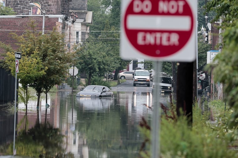
More flooding downpours are possible in the Philly region. A heat advisory is in effect through Saturday.
Philadelphia is beginning to feel like Miami North.
Skin-clinging humidity, random downpours, heat indexes in triple figures, steamy nights. Welcome to Miami North.
The heat advisory for the entire region has been extended to 8 p.m. Saturday, with more random showers likely. As to when something resembling comfort returns to Philly? “That’s the million-dollar question,” said Matt Benz, senior meteorologist with AccuWeather Inc.
Similar conditions could persist into late next week, he added.
Highs might not get much past 90, but with the atmosphere this steamy, the heat index in Philly had reached 102 at 2 p.m. (In Miami, it was down to 82, thanks to a cooling thunderstorm.)
Both Camden and Delaware Counties have posted “code red” heat advisories, even though conditions are not expected to approach the official criteria of two consecutive days of highs of at least 95 degrees.
Waves of air from the Gulf Stream and the gulf itself continue to wash over the Mid-Atlantic region, said Brian Hurley, senior branch forecaster at the federal Weather Prediction Center in College Park, Md., adding that the situation is going to persist.
On the plus side, drought conditions continue to ease, and officially in Philadelphia, rainfall since Jan. 1 is now about normal, recent rains having wiped out a significant deficit.
Officially, both the entire state of New Jersey and Chester County are under state-imposed “drought warnings,” but changes may be in the wind and the clouds.
Three months ago, all of New Jersey was in at least “moderate drought,” according to the interagency U.S. Drought Monitor, but with Thursday’s update, less than half the state was so designated. As for Chester County, the percentage of the county in “severe drought” has dropped from 90% to 37% in the same period.
However, the recent rains have come in fits and starts and have been less generous in some areas and overly generous elsewhere, and have had a knack for outwitting science.
Those random downpours are going to continue
“Multiple rounds of showers and thunderstorms each afternoon and evening may become strong to severe,” the National Weather Service in Mount Holly warned Thursday.
Don’t expect much notice.
Case in point: Around 7:30 p.m. Wednesday, the weather service posted a missive: “The threat for flooding has diminished tonight.”
Shortly thereafter, flood warnings went up for portions of all four of Philly’s neighboring Pennsylvania counties.
That followed afternoon downpours that caused extensive road flooding in Philly and neighboring areas as a corridor of heavy rain cut through the city.
Michael Silva, a meteorologist in the Mount Holly office, was among those who had not seen it coming.
“Before work, I was about to go out twice for walks,” Silva said. “Then I looked at the radar.”
Despite all the rain, and probably as result of the antecedent dryness — heading into July, Philadelphia had experienced 16 consecutive months of below-normal rainfall — stream and river levels remain well below the danger zones.
And so far, the trees appear to be holding their ground, said Shane Farrell, arborist with the Davey Tree Expert Co., and to date he has not seen the type of “mud slurry” that might coax them out of their roots, barring severe-storm gusts.
Showers are likely to be numerous and widespread on Friday, said AccuWeather’s Benz.
The outlook for the weekend for Philly and the Shore
Saturday is expected to be a clone of Thursday, as a so-called Bermuda high-pressure system over the North Atlantic continues to lure steamy air northward. Winds circulate clockwise around centers of high pressure; thus, areas to the west of the center, where Philly happens to be, experience winds from the south and southwest.
Benz sees an outside chance that an approaching front will provide a very temporary and modest measure of relief on Sunday. Don’t bet on it, however. He said it is going to encounter a whole lot of resistance along the way.
The outlooks are similar for the Jersey Shore, which is likely to be quite a popular destination this weekend.