Heavy rain and flooding Sunday threaten Jersey Shore as rare nor’easter howls on
The soggy weather was forecast to linger in the Philadelphia region, with minor flooding possible.
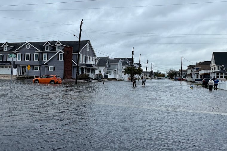
Dozens of people were evacuated from their homes and rescued from cars on flooded roadways this weekend as a rare nor’easter swamped much of the Jersey Shore, New Jersey Gov. Mikie Sherrill said Sunday at a news conference.
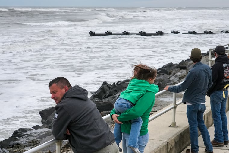
Persistent showers, high winds, massive waves, and cascading floodwaters have engulfed the Shore, as the storm howls off the Eastern Seaboard. The threat of more surges, coastal flooding, and power outages continued Sunday.
“Our Shore communities have been hit hard, and we’re monitoring the damage closely,” Sherrill said. But, she said, “we’re not out of the woods just yet.”
» READ MORE: The Jersey Shore is bracing for a big September storm — but it’s a nor’easter, not a hurricane
According to Sherrill, the early-season nor’easter caused severe dune loss in Atlantic City and Brigantine — with the Brigantine mayor calling it the worst tidal flooding since Superstorm Sandy in 2012, according to the Press of Atlantic City.
Wind speeds in Surf City reached 74 mph, and some coastal towns saw up to 3 inches of rain, with more on the way Sunday, the governor said.
“We were able to minimize damage because we were ready for this storm,” said Sherrill, who issued a state of emergency Friday.
On Sunday morning, a coastal flood warning was in effect as the morning high tide came in down the Shore.
Over the next few hours, the high tide is expected to work its way into the back bays and lagoon communities, likely leading to moderate flooding with the possibility of isolated pockets of more severe flooding, said National Weather Service meteorologist Ray Kruzdlo.
“I don’t think we’re going to see what we saw two high tide cycles ago, but it’s still going to be impactful,” Kruzdlo said. Those water levels may take a few days to recede.
Sherrill said officials were also concerned about possible flooding after high-tide Monday morning.
“As for the wind, it is starting to subside,” Kruzdlo said. “The low pressure responsible for this whole nor’easter, it’s kind of wobbling around a little bit. It’ll get out of here within 24 hours.”
A high wind warning remains in effect until noon in central and north New Jersey.
With a high surf and rip currents, people should avoid the ocean, he said. “There has been beach erosion, so even accessing the beaches could be a dangerous thing right now.”
In the Philly region, the heavy rain people saw overnight and this morning is headed out of town toward Wilmington, Kruzdlo said. Showers will continue throughout the day. Minor flooding is possible. There is a chance of showers overnight tonight and early tomorrow.
This is a developing story that will be updated.