Storm warnings have been outdoing the actual storms in the Philly area
Thunderstorm forecasting remains one of the most-elusive pursuits in meteorology.
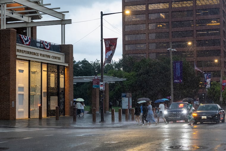
The smartphone alerts and the battery of weather watches and warnings were chilling. But they failed to capture what actually happened in the immediate Philadelphia area.
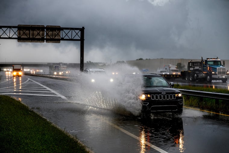
As it turned out Tuesday, not all that much happened, beyond a beneficial rainfall, some flashbulb lightning, and wind gusts that officially did not get past 34 mph. Heavy rains hammered Upper Bucks County, but around Philly, creeks behaved and flooding reports were isolated, even as damaging storms struck to the north and south of the region.
As so often occurs with summer thunderstorm outbreaks — not to mention winter storms — we learned science is playing catch-up with the atmosphere. That was evident Tuesday night, and if you feel as though you’ve seen this movie before, the forecasts and the outcomes were similar on July 18 and 21.
And expect recurrences — and surprise storms — even if the climate stops changing.
The atmosphere still is jealously guarding some of its most important secrets, said Bill Bunting, deputy director of the federal Storm Prediction Center, the national house of mayhem in Norman, Okla., that is responsible for all the severe-storm and tornado watches.
In his 40-plus years in the storm-forecasting business, Bunting said, “I have seen remarkable progress, but we’re nowhere near perfection. In the end, the science has its limitations.”
About the Tuesday night storms
Life is unfair, and that works both ways. The Philly region has had its share of storm ambushes historically, and as for what did not happen in and around the city Tuesday, “we’ll consider that a much more fortunate outcome than what could have been,” said Mike Lee, meteorologist at the National Weather Service office in Mount Holly.
The outcome was similar to that of July 18 and July 21, when the menu of threats — wind, possible floods and tornadoes, lightning — was about the same. The gusts on the 18th did not get above 35 mph at Philadelphia International Airport, and they did not get above 30 mph on the 21st.
Bunting said this week’s storms were particularly problematical meteorologically. “The wind fields were quite strong” in the upper atmosphere, he said. “That environment was not one to mess around with.”
It was as though the system had wandered in from a different season, when cooler temperatures create sharp temperature contrasts that drive storm development, Lee’s colleague Patrick O’Hara said.
At 12:50 p.m., the storm center had seen enough to issue a broad-brush severe-thunderstorm watch that covered a huge swath of the Mid-Atlantic region, including much of Pennsylvania and all of New Jersey and Delaware.
A tornado watch followed a few hours later.
The Mount Holly office issued two tornado warnings for the Philly area — including one covering Wilmington and Chester City.
However, the two twisters verified by the Mount Holly office occurred in Talbot County, Md.
The heaviest rains — in some cases over 4 inches in Quakertown — mostly were confined well to the north of Philly. Officially, 0.72 inches of rain was measured at PHL.
Wind-damage and flooding reports around the Philly area were sparse, although Bunting advised it can take days following a storm to get an accurate assessment of impacts.
The future of thunderstorm forecasting
Bunting suggested that complaints about forecast accuracy could be viewed as forms of flattery, since they well from the public’s expectations that, in turn, well from advances in forecasting.
In 1985, Bunting recalled, he was working with one computer-model output that he received via a fax machine, and observation tools primitive by today’s standards.
But forecasting the development and movement of thunderstorms remains one of the great challenges of meteorology, and it is inevitable that storms are not going to materialize in some areas that are under a storm watch.
“You don’t now exactly where those storms will organize into a cluster, or fast-moving line segment,” he said. “So you have to put larger areas on notice.”
A wild card in any cluster or line of storms would be renegade, isolated storms, the kind that are apt to spin up a tornado, Bunting said.
For any given storm, he said, “until it forms in a larger area with similar conditions, it’s hard to pinpoint the risk.”
What would it take to pinpoint the risks? Improved understanding of storm physics, improved remote-sensing capabilities, and more powerful models, Bunting said.
“It is not a trivial challenge,” he said. “The decisions are not going to be perfect.”
That is not necessarily a bad development, he added.
“Sometimes I wonder what it would be like if we knew what the weather would be in great detail, weeks and months advance,” he said. “It seems to me it would get kind of old.”